About Me
Based in London, I have over 15 years experience developing innovative technology solutions for government & private organisations looking to influence travel behaviour and improve access to mobility. I provide technical advice, solutions architecture, cloud management, data management & analytics and full stack development skills. I am strongly immersed in the JavaScript world alongside location/mobility systems.

Work
I am generally involved in all stages of the project lifecycle, providing development and consultancy services.
Typical applications:
- Multi-modal Journey Planners
- Walk/Cyle Planners
- Realtime & Schedule Apps
- Transit Mapping Apps
- Departure Display Boards
- Engagement Platforms
- Gamification Travel Apps
- Insights Dashboards
- Data Storytelling Apps
- Travel Surveys
- Travel Time Analysis
- Location Analysis
- Fares Scrapers
Featured Projects
Data Storytelling app which provides insights into the impact of COVID19 on micromobiliry across 6 US cities
Following initial research, I sourced, transformed and aggrogated the data overcoming data processing problems from working with various source and developed a vibrant data storytelling app. Includes various visualisations showcasing the total trips, trip lengths, trip distribution by hour and popular bike stations, which helped to clearly show the trends from 2019 to 2021. Postgres was utilised to manage over 20 GB of trip data and serve at high performance to a Express/Vue application.
us-micromobility-trends.netlify.app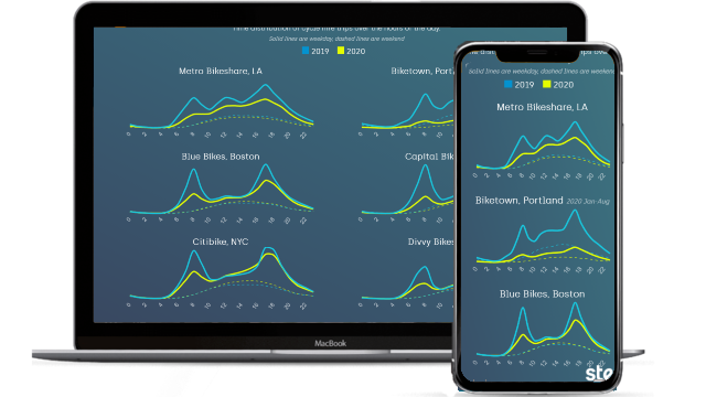
Fares Visualisation Tool to visualise and compare fares based on form inputs
Proposed and developed an advanced fares visualisation tool to rapidly illustrate how different fare structures could impact travelling across Toronto. Postgres was utilised to manage over 30 GB of fares data and serve at high performance to a ExpressJS powered app.
metrolinx-fares.steer-apps.com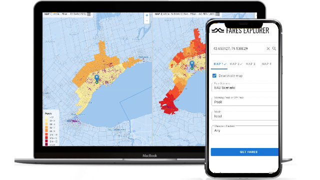
Travel survey type tool that makes personal sustainable travel change recommendations
Proposed and developed the entire application based on client direction and design guidelines. Provides user specific cost, environmental and health benefits and nearest car clubs bike share schemes. Complex logic required to make recommendations based on user inputs. The app was powered by postcode and shared mobility data and contains feedback system and admin control panel.
travelbetter.como.org.uk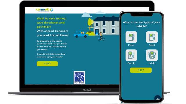
Data Storytelling app which provides insights into the impact of COVID19 on cycle hire in London.
I came up with the concept, pulled out the stats from the data, designed and developed the entire application with feedback from colleagues.
covidcyclehire.steergroup.com
Dashboard providing insights into various mobility trends and death/cases for countries/regions as time series charts including animated world map.
I came up with the concept after finding out about Google's community mobility reports and served the data via PostGres, designed and developed the entire application with feedback from colleagues. I wanted it to show multiple country comparisons.
covid-mobility-trends.steer-apps.com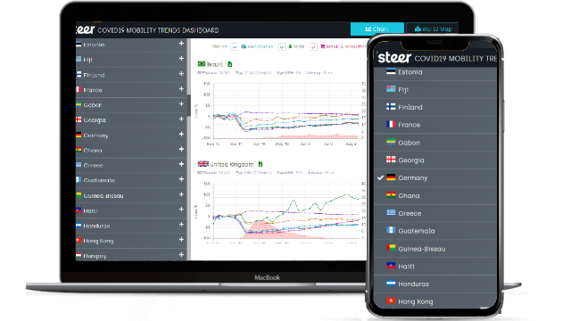
Prototype Journey Planner focused on accessible walking across Toronto. Includes options such as step free crossings.
I designed and developed the application based on a set of spatial data and some basic requirements to test the accessibility of the network.
www.to360planner.com
Modern Journey Planner for region of Hampshire with focus on sustainability and MaaS.
I designed and developed the entire platform and helped client define their requirements.
journeyplanner.myjourneyhampshire.com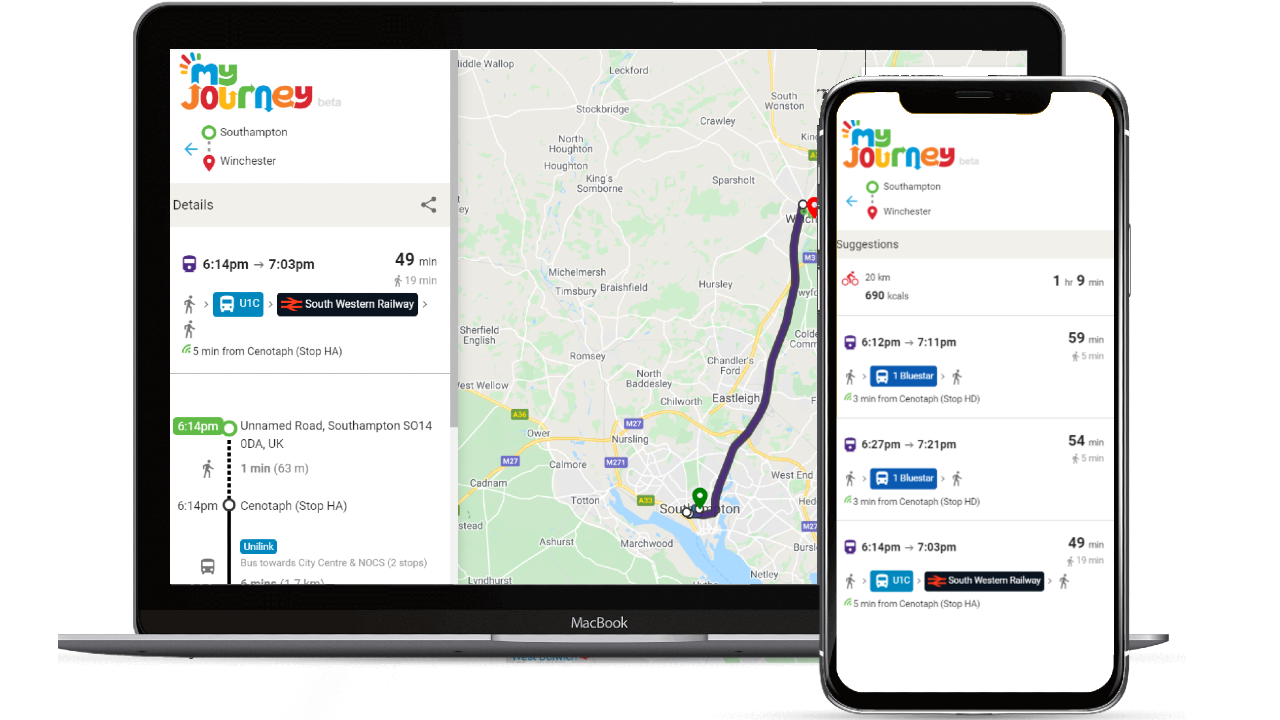
Engagement platform for residents to view and provide location specific feedback on official findings on air quality & traffic. Includes social interactions and admin dashboard for sentiment analysis and KPIs.
I designed and developed the entire platform based on client requirements.
ohs-dulwich.co.uk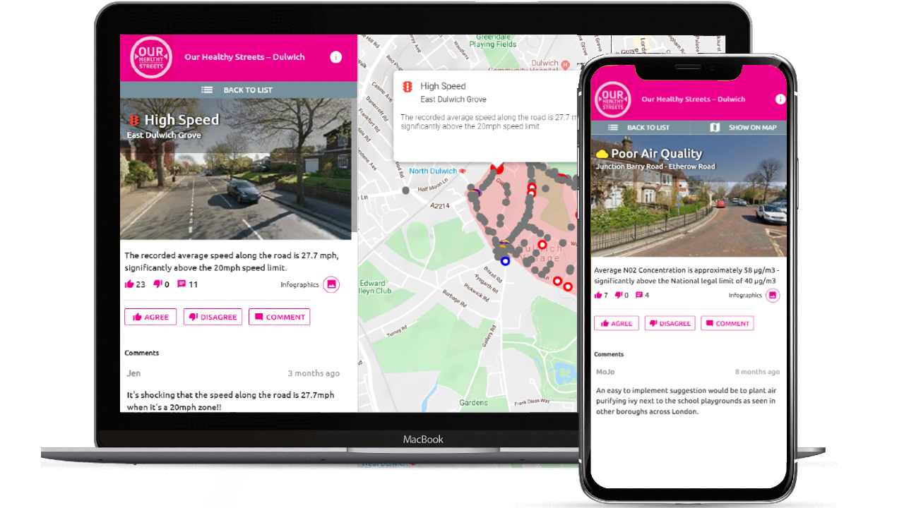
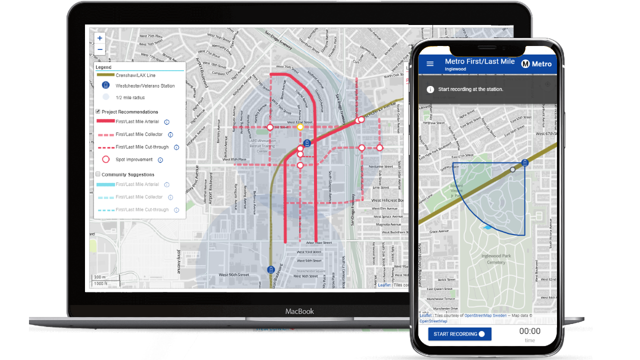
Rail station audit app that allowed auditors to collect location specific information, including photos and identifying barriers/opportunities for three new rail stations in Inglewood, California. Post audit, the findings were made public via an interactive dashboard which showcased audit map hotspots, key stats and CSV report downloads.
I developed the front-end build, back-end build, database design, documentation, cloud hosting and source control.
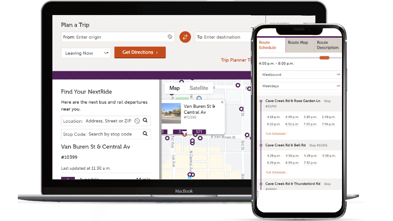
Regional Journey Planner and Schedules & Real-time web apps. Showcased an intuiitive approach for obtaining schedules and real-time information from web platforms.
I developed the UI and back-end services working with various datasets and location & real-time APIs
Branding and static website.
I designed and developed the branding & website and guided client on requirements.
www.bwdeveloper.co.uk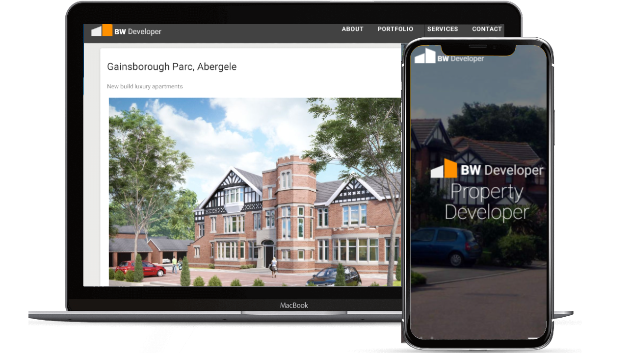
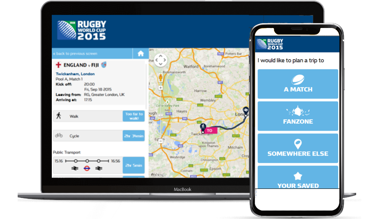
Official Journey Planner for the Rugby World Cup 2015 which assisted ticketholders in arriving and leaving venues and fan zones. Includes walk, cycle, public transit, taxi, accessible and park and ride options with detailed venue information.
I developed the application with various location & mapping APIs. Won best Digital Transport award in 2015.
Customisable dashboard that shows various live transport features located near the office such as nearby cycle docking stations and availabilty, nearby stations and stops with real-time, street traffic cams, road disruptions and weather.
Research project whereby I envisaged a dashboard of various travel options specific to my office.
mobility-dashboard.herokuapp.com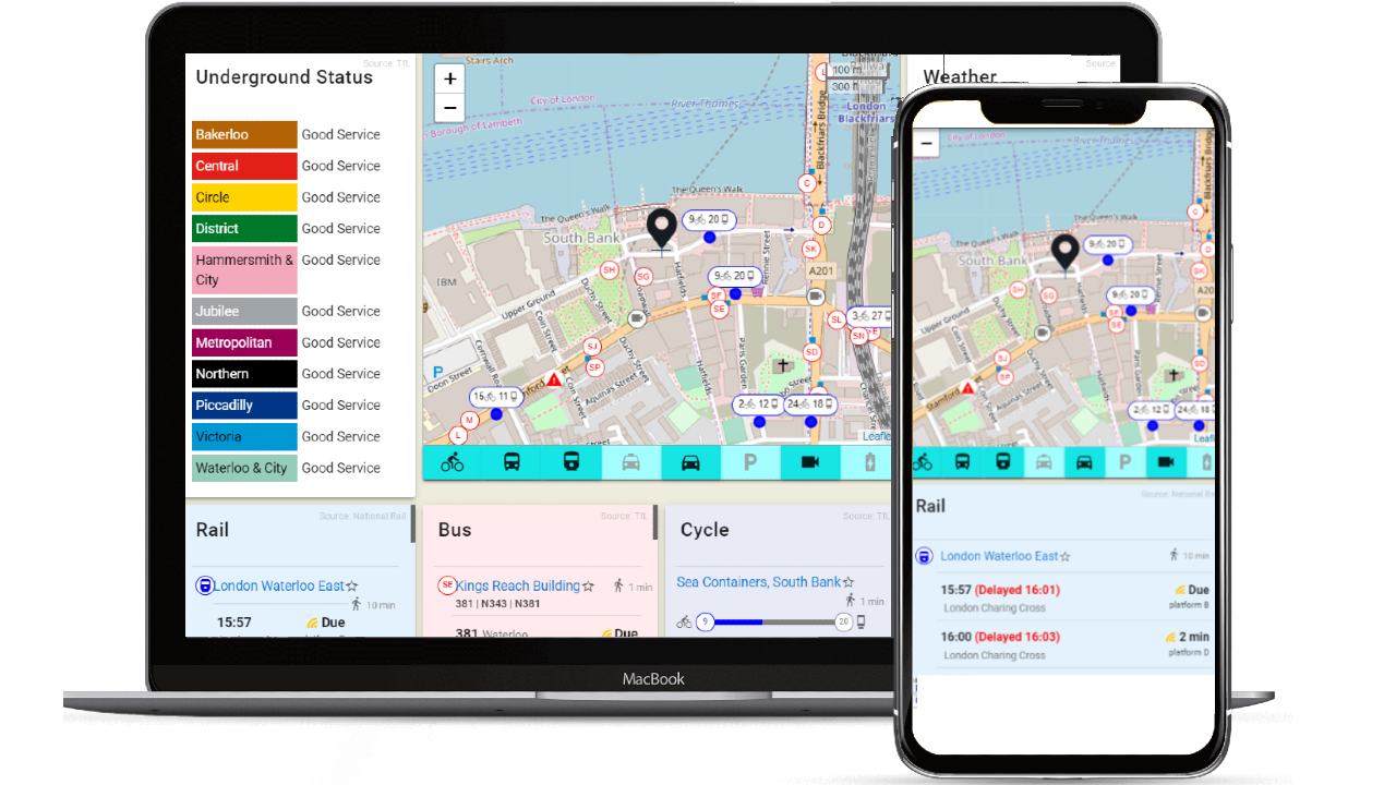
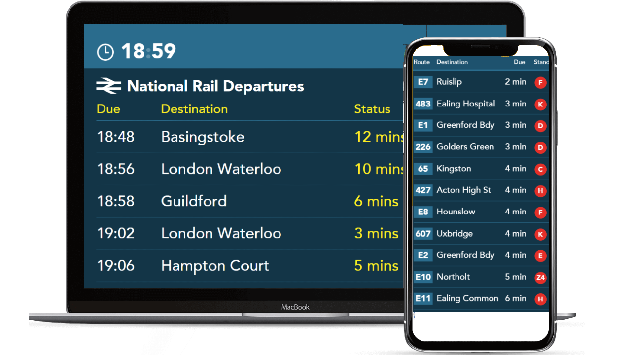
Live departures for nearby stops and stations in Ealing, displayed on totem outside the main rail station.
I built the front-end and connected the real-time services for large screen display.
Skills
- HTML5, CSS3, SASS
- JS, ES6, ES2017
- Vue, Svelte
- Bootstrap, Vuetify, Bulma
- Leaflet, Google Maps, Mapbox
- D3, ChartJS
- Node, PHP, Python
- Express, Laravel, Fastify
- MySQL, PostGIS
- Geoserver, pgRouting, OpenTripPlanner
- APIs: Google Maps, Mapbox, MapQuest, HERE, OneBusAway
- Data: GTFS, ATCO-CIF, Naptan
- GIT, Gitflow, Github, Bitbucket
- SCRUM, Kanban, Trello, JIRA, Zoho
- GCP, Digital Ocean, Netlify
- Docker, Dokku, Bash, SSH, Cordova
- Responsive Design
- RESTful API Design
- Component UI Design
- Application Architecture
- Cloud Management